CryoTEMPO-EOLIS: Elevation Over Land Ice from Swath
The CryoTEMPO-EOLIS products
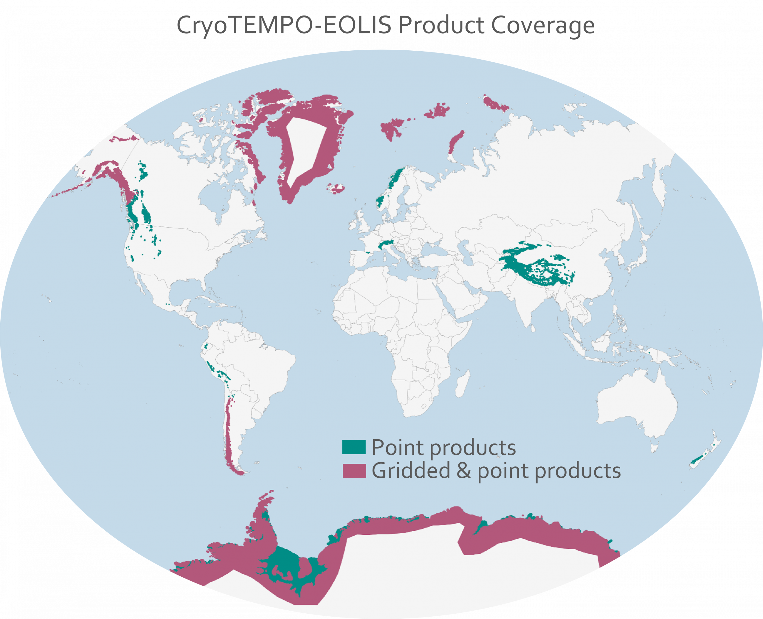
The EOLIS products exploit CryoSat’s SARIn mode and the novel swath processing technique to deliver increased spatial and temporal coverage of time-dependent elevations over land ice, a critical metric for tracking ice mass trends. The CryoTEMPO EOLIS products are the operational result of the CryoSat+ CryoTop, CryoTop evolution ESA STSE and CryoSat+ Mountain Glaciers research and development projects.
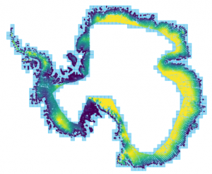
SWATH THEMATIC POINT PRODUCT
The EOLIS point product contains a dense set of elevation measurements for individual observations.